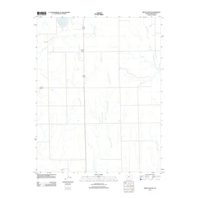
2012 Map of Protection NE
USGS Topo · Published 2012About this map
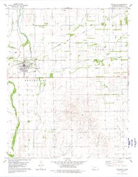
Lake Coldwater anchors the northern reaches of this Comanche County landscape, providing a significant water feature in an area otherwise defined by the dendritic drainage patterns of the High Plains. The Salt Fork Arkansas River bisects the terrain from north to south, winding through a grid of section lines that mark the region’s agricultural heritage. This 2012 survey captures a rural environment where infrastructure like the Comanche County Airport and Camp Lark sit alongside long-established landmarks. For those tracing family roots in the area, the southern portion of the map includes the Avilla Cem, a vital point of reference for local genealogy. The map also detail seasonal watercourses including Cavalry Cr and the W Br Nescatunga Cr, which illustrate the natural hydrology that has shaped land use in this part of Kansas for generations.
Find a feature on this map
7 named features on this map. Tap any name to fly to it.
Don’t see what you’re looking for? This feature index may not catch every label — zoom into the map to look around manually.
Map Details
Editions of this 2012 Protection NE Map
This is the sole edition of this map. No revisions or reprints were ever made.
Other maps of this area

1892 · Coldwater
USGS Topo · 1:125,000

1955 · Pratt
USGS Topo · 1:250,000

1959 · Pratt
USGS Topo · 1:250,000

1979 · Coldwater
USGS Topo · 1:24,000

1979 · East Kiowa Creek South
USGS Topo · 1:24,000

1979 · Protection NE
USGS Topo · 1:24,000
1979 · Nescatunga Creek South
USGS Topo · 1:24,000
1980 · Nescatunga Creek North
USGS Topo · 1:24,000
1980 · Protection SW
USGS Topo · 1:24,000
1980 · Protection
USGS Topo · 1:24,000