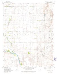
1980 Map of Protection SW
USGS Topo · Published 1980About this map
The Cimarron River carves a broad path through the southern reaches of this landscape, marking a significant hydrologic feature in Comanche County. Further north, the Old Indian Treaty Boundary stretches across the township lines, providing a clear cartographic link to the region's complex 19th-century land divisions and tribal histories. This intersection of natural and political history is anchored by the Mennonite Cem in the northwest, suggesting the early settlement patterns of religious communities on the High Plains. Drainage is defined by the winding course of Cavalry Creek and Bluff Creek, while a localized Gaging Sta along the river highlights the importance of water monitoring in this arid environment. The map captures a moment when traditional agrarian boundaries and modern infrastructure, such as a long-distance Pipeline, coexisted across the prairie.
Find a feature on this map
11 named features on this map. Tap any name to fly to it.
Don’t see what you’re looking for? This feature index may not catch every label — zoom into the map to look around manually.
Map Details
Editions of this 1980 Protection SW Map
This is the sole edition of this map. No revisions or reprints were ever made.
Other maps of this area

1892 · Coldwater
USGS Topo · 1:125,000

1894 · Sitka
USGS Topo · 1:62,500

1896 · Ashland
USGS Topo · 1:125,000

1955 · Woodward
USGS Topo · 1:250,000

1955 · Pratt
USGS Topo · 1:250,000

1958 · Woodward
USGS Topo · 1:250,000

1959 · Pratt
USGS Topo · 1:250,000

1970 · Lookout
USGS Topo · 1:24,000

1970 · Selman NW
USGS Topo · 1:24,000

1970 · Buffalo NE
USGS Topo · 1:24,000