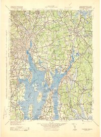
1943 Map of Providence
USGS Topo · Published 1943About this map
The industrial and maritime corridors of Narragansett Bay and the Blackstone River are frozen in time during the mid-war period. This Corps of Engineers survey illustrates the dense urban centers of Pawtucket, Central Falls, and Woonsocket, where the Nynh&H RR network and textile mill history are visibly etched into the landscape. Maritime infrastructure is highly detailed, featuring navigation aids like the Pomham Rock Lighthouse, Fuller Rock Lth, and Sabine Pt Lighthouse guarding the approaches to Providence.
Find a feature on this map
365 named features on this map. Tap any name to fly to it.
Don’t see what you’re looking for? This feature index may not catch every label — zoom into the map to look around manually.
Map Details
Editions of this 1943 Providence Map
This is the sole edition of this map. No revisions or reprints were ever made.
Other maps of this area

1885 · New Bedford
USGS Topo · 1:62,500

1885 · Abington
USGS Topo · 1:62,500

1885 · Sakonnet
USGS Topo · 1:62,500

1885 · Middleboro
USGS Topo · 1:62,500

1885 · Taunton
USGS Topo · 1:62,500

1886 · Blackstone
USGS Topo · 1:62,500

1886 · Dedham
USGS Topo · 1:62,500

1887 · Franklin
USGS Topo · 1:62,500

1887 · Providence
USGS Topo · 1:62,500

1888 · New Bedford
USGS Topo · 1:62,500