
1947 Map of Providence
USGS Topo · Published 1948About this map
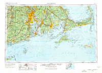
Providence serves as the focal point of this regional study, which captures the industrial and maritime landscape of southern New England just after the war. The map illustrates a dense network of urban centers including Fall River, New Bedford, and Pawtucket, linked by the N.Y. N.H. & H. RR and an evolving system of post-war highways. Significant military installations define the coastal character, from the U.S. Naval Reservation and Quonset Point to a series of defensive fortifications such as Fort Wetherill and Fort Adams guarding the entrance to Narragansett Bay.
Find a feature on this map
294 named features on this map. Tap any name to fly to it.
Don’t see what you’re looking for? This feature index may not catch every label — zoom into the map to look around manually.
Map Details
Editions of this 1947 Providence Map
5 editions found
Other maps of this area

1885 · New Bedford
USGS Topo · 1:62,500

1885 · Abington
USGS Topo · 1:62,500

1885 · Sakonnet
USGS Topo · 1:62,500

1885 · Duxbury
USGS Topo · 1:62,500

1885 · Middleboro
USGS Topo · 1:62,500

1885 · Taunton
USGS Topo · 1:62,500

1886 · Falmouth
USGS Topo · 1:62,500

1886 · Blackstone
USGS Topo · 1:62,500

1886 · Plymouth
USGS Topo · 1:62,500

1886 · Dedham
USGS Topo · 1:62,500