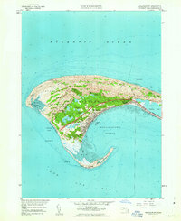
1958 Map of Provincetown
USGS Topo · Published 1963About this map
Provincetown sits at the tip of the Cape, defined by a complex geography of shifting sands and historic maritime infrastructure. In this mid-century revision, the town's grid is anchored by the Pilgrim Monument and the Municipal Wharf, while the surrounding Province Lands State Reservation protects a landscape of freshwater bodies like Shank Painter Pond and Clapps Pond. The map captures the infrastructure of the era, from the Provincetown Airport tucked behind the dunes to the coastal defenses of the Race Point Coast Guard Sta. Navigational aids essential to maritime history, including Race Point Lighthouse, Wood End Lighthouse, and the beacon at Long Point, trace the treacherous hook of the harbor. Inland, the track of the New York New Haven and Hartford railroad line remains visible alongside the emerging State Highway, marking the transition from rail to automotive tourism near Mayflower Heights.
Find a feature on this map
46 named features on this map. Tap any name to fly to it.
Don’t see what you’re looking for? This feature index may not catch every label — zoom into the map to look around manually.
Map Details
Editions of this 1958 Provincetown Map
3 editions found
Other maps of this area

1887 · Wellfleet
USGS Topo · 1:62,500

1887 · Provincetown
USGS Topo · 1:62,500

1889 · Provincetown
USGS Topo · 1:62,500

1889 · Wellfleet
USGS Topo · 1:62,500

1893 · Wellfleet
USGS Topo · 1:62,500

1898 · Provincetown
USGS Topo · 1:62,500

1942 · Cape Cod Bay
USGS Topo · 1:125,000

1944 · Provincetown
USGS Topo · 1:31,680
1944 · North Truro
USGS Topo · 1:31,680

1947 · Providence
USGS Topo · 1:250,000