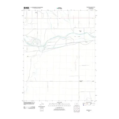
2010 Map of Prowers
USGS Topo · Published 2010About this map
Old Fort Lyons stands as a significant landmark on the northern banks of the Arkansas River, anchoring a landscape defined by early irrigation and prairie settlement. The river corridor is flanked by the Big Timbers woodland, a historic riparian zone that contrasts with the surrounding agricultural grid. An intricate network of water management features, including the Keesee Canal, Fort Bent Canal, and McClave Drainage Ditch, illustrates the engineering required to sustain the communities of Prowers and Able. Local history and genealogy researchers will find several quiet markers of the area's past, from The Home Cemetery in the north to Hight Cemetery near Four Corners Crossing. The map traces the convergence of natural waterways like Mud Creek and Graveyard Creek with the rigid county road system, reflecting the transition from frontier river passage to structured rural township.
Find a feature on this map
31 named features on this map. Tap any name to fly to it.
Don’t see what you’re looking for? This feature index may not catch every label — zoom into the map to look around manually.
Map Details
Editions of this 2010 Prowers Map
This is the sole edition of this map. No revisions or reprints were ever made.
Other maps of this area

1892 · Lamar
USGS Topo · 1:125,000

1892 · Two Butte
USGS Topo · 1:125,000

1893 · Two Butte
USGS Topo · 1:125,000

1952 · Lamar West
USGS Topo · 1:24,000

1953 · Hasty
USGS Topo · 1:24,000

1953 · Prowers
USGS Topo · 1:24,000

1954 · Lamar
USGS Topo · 1:250,000

1955 · McClave
USGS Topo · 1:24,000

1955 · Lubers
USGS Topo · 1:24,000

1955 · Wiley
USGS Topo · 1:24,000