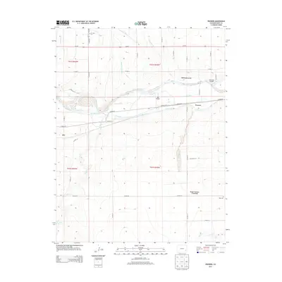
2013 Map of Prowers
USGS Topo · Published 2013About this map
Old Fort Lyons and the woodland area known as Big Timbers anchor this section of the Arkansas River valley in the early 21st century. The landscape is defined by an extensive network of historic water management features, including the Keesee Canal, Fort Bent Canal, Sunflower Ditch, and Amity Canal, reflecting the region's agricultural reliance on the river's flow. Small settlements and transit points like Prowers, Able, and Four Corners Crossing dot the plains north and south of the river corridor.
Find a feature on this map
42 named features on this map. Tap any name to fly to it.
Don’t see what you’re looking for? This feature index may not catch every label — zoom into the map to look around manually.
Map Details
Editions of this 2013 Prowers Map
This is the sole edition of this map. No revisions or reprints were ever made.
Other maps of this area

1892 · Lamar
USGS Topo · 1:125,000

1892 · Two Butte
USGS Topo · 1:125,000

1893 · Two Butte
USGS Topo · 1:125,000

1952 · Lamar West
USGS Topo · 1:24,000

1953 · Hasty
USGS Topo · 1:24,000

1953 · Prowers
USGS Topo · 1:24,000

1954 · Lamar
USGS Topo · 1:250,000

1955 · McClave
USGS Topo · 1:24,000

1955 · Lubers
USGS Topo · 1:24,000

1955 · Wiley
USGS Topo · 1:24,000