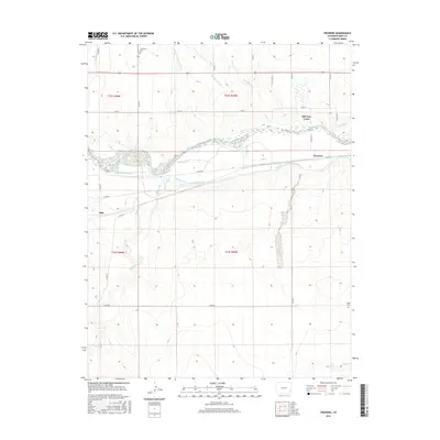
2016 Map of Prowers
USGS Topo · Published 2016About this map
The Arkansas River defines the central axis of this High Plains landscape, where an intricate network of irrigation and drainage infrastructure transformed the semi-arid terrain of Bent and Prowers Counties. Historical sites like Old Fort Lyons stand near the riverbanks, representing the deep layering of settlement in southeastern Colorado. The map reveals the vital role of water management in this agricultural region, tracing the paths of the Fort Bent Canal, Keesee Canal, and Amity Canal as they divert water to the surrounding fields. Smaller watercourses such as Graveyard Cr and Mud Creek intersect the grid of county roads, while isolated landmarks like The Home Cem and Hight Cem provide essential anchor points for genealogists and local historians. The proximity of the small settlements of Prowers and Able to these water-control features like the McClave Drainage Ditch and Sunflower Ditch illustrates the early 21st-century relationship between town sites and the managed river valley.
Find a feature on this map
34 named features on this map. Tap any name to fly to it.
Don’t see what you’re looking for? This feature index may not catch every label — zoom into the map to look around manually.
Map Details
Editions of this 2016 Prowers Map
This is the sole edition of this map. No revisions or reprints were ever made.
Other maps of this area

1892 · Lamar
USGS Topo · 1:125,000

1892 · Two Butte
USGS Topo · 1:125,000

1893 · Two Butte
USGS Topo · 1:125,000

1952 · Lamar West
USGS Topo · 1:24,000

1953 · Hasty
USGS Topo · 1:24,000

1953 · Prowers
USGS Topo · 1:24,000

1954 · Lamar
USGS Topo · 1:250,000

1955 · McClave
USGS Topo · 1:24,000

1955 · Lubers
USGS Topo · 1:24,000

1955 · Wiley
USGS Topo · 1:24,000