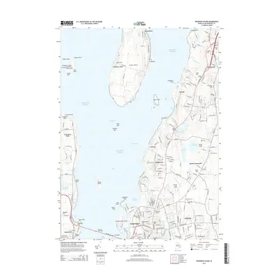
2015 Map of Prudence Island
USGS Topo · Published 2015About this map
Prudence Island sits at the center of this coastal landscape, flanked by the waters of Narragansett Bay and the Atlantic Ocean. To the north, the small settlements of Homestead and Prudence Park anchor the island, while to the east, the mainland portion of Aquidneck Island shows a more dense pattern of habitation. Here, the town of Portsmouth and the community of Middletown are connected by a network of local roads and larger landmarks such as the Newport State Airport. This survey captures the region's balance between residential growth and its longstanding maritime and agricultural roots, evidenced by features like the Lawton Valley Reservoir and numerous local hills such as Quaker Hill and Slate Hill. To the south, the northern reaches of Newport appear with prominent landmarks like Miantonomi Hill and the approach to the Newport Toll Bridge, illustrating the vital transportation links that connect these island communities.
Find a feature on this map
74 named features on this map. Tap any name to fly to it.
Don’t see what you’re looking for? This feature index may not catch every label — zoom into the map to look around manually.
Map Details
Editions of this 2015 Prudence Island Map
This is the sole edition of this map. No revisions or reprints were ever made.
Other maps of this area

1885 · Sakonnet
USGS Topo · 1:62,500

1888 · Fall River
USGS Topo · 1:62,500

1888 · Sakonnet
USGS Topo · 1:62,500

1889 · Newport
USGS Topo · 1:62,500

1890 · Narragansett Bay
USGS Topo · 1:62,500

1892 · Narragansett Bay
USGS Topo · 1:62,500

1893 · Sakonnet
USGS Topo · 1:62,500

1893 · Fall River
USGS Topo · 1:62,500

1894 · Newport
USGS Topo · 1:62,500

1904 · Newport
USGS Topo · 1:62,500