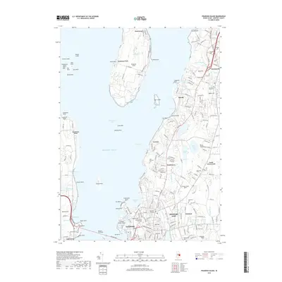
2018 Map of Prudence Island
USGS Topo · Published 2018About this map
Prudence Island dominates the center of this Narragansett Bay landscape, showcasing the isolated settlements of Homestead and Prudence Park before the surrounding waters of the East Passage and Narragansett Bay. The map captures the complex shoreline and residential expansion of Aquidneck Island to the east, spanning from Portsmouth and Melville down through Middletown to Newport East. This maritime corridor is defined by its strategic naval and aviation history, evidenced by Newport State Airport and the dense infrastructure surrounding Coddington Cove.
Find a feature on this map
87 named features on this map. Tap any name to fly to it.
Don’t see what you’re looking for? This feature index may not catch every label — zoom into the map to look around manually.
Map Details
Editions of this 2018 Prudence Island Map
This is the sole edition of this map. No revisions or reprints were ever made.
Other maps of this area

1885 · Sakonnet
USGS Topo · 1:62,500

1888 · Fall River
USGS Topo · 1:62,500

1888 · Sakonnet
USGS Topo · 1:62,500

1889 · Newport
USGS Topo · 1:62,500

1890 · Narragansett Bay
USGS Topo · 1:62,500

1892 · Narragansett Bay
USGS Topo · 1:62,500

1893 · Sakonnet
USGS Topo · 1:62,500

1893 · Fall River
USGS Topo · 1:62,500

1894 · Newport
USGS Topo · 1:62,500

1904 · Newport
USGS Topo · 1:62,500