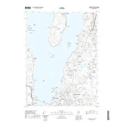
2021 Map of Prudence Island
USGS Topo · Published 2021About this map
Rhode Island and its surrounding waters in the East Passage and Narragansett Bay define this 2021 topographic record. The land is densely marked by the lineage of early settlers, evidenced by an extraordinary concentration of small family burial grounds such as the Captain Clarke - Cornell Lot Cem and the Sisson - Carr Lot Cem. This pattern suggests a deeply rooted agrarian history where family homesteads maintained private plots for generations. On Prudence Island, the landscape is more varied, featuring the Schoolhouse Swamp and the small settlements of Homestead and Prudence Park. Infrastructure such as the Newport Toll Bridge and Newport State Airport contrasts with the numerous historic sites, including the Portsmouth Friends Churchyard Cem and the evocatively named Hessians Hole. The map serves as a vital tool for genealogists and local historians tracing the physical evolution of these coastal communities.
Find a feature on this map
244 named features on this map. Tap any name to fly to it.
Don’t see what you’re looking for? This feature index may not catch every label — zoom into the map to look around manually.
Map Details
Editions of this 2021 Prudence Island Map
This is the sole edition of this map. No revisions or reprints were ever made.
Other maps of this area

1885 · Sakonnet
USGS Topo · 1:62,500

1888 · Fall River
USGS Topo · 1:62,500

1888 · Sakonnet
USGS Topo · 1:62,500

1889 · Newport
USGS Topo · 1:62,500

1890 · Narragansett Bay
USGS Topo · 1:62,500

1892 · Narragansett Bay
USGS Topo · 1:62,500

1893 · Sakonnet
USGS Topo · 1:62,500

1893 · Fall River
USGS Topo · 1:62,500

1894 · Newport
USGS Topo · 1:62,500

1904 · Newport
USGS Topo · 1:62,500