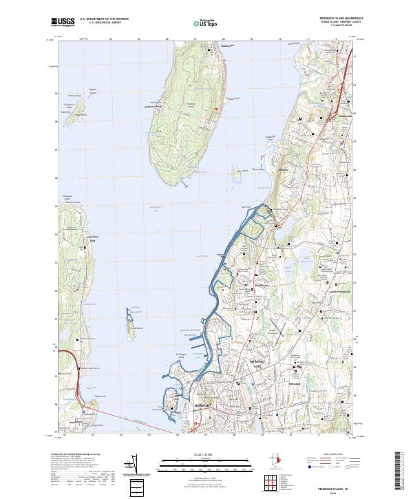
2024 Map of Prudence Island
USGS Topo · Published 2024About this map
Narragansett Bay serves as the focal point of this survey, defining the coastal identities of Prudence Island, Jamestown, and the northern reaches of Newport. The landscape is heavily marked by familial and community lineage, evidenced by the dense concentration of small burial grounds such as the Captain Job Lawton Lot Cem and Joseph Fish Lot Cem that dot the countryside between Portsmouth and Middletown. These sites, alongside larger religious landmarks like Saint Mary's Episcopal Churchyard Cem, suggest a deeply rooted settlement pattern where private family plots have been preserved amidst modern infrastructure.
Find a feature on this map
117 named features on this map. Tap any name to fly to it.
Don’t see what you’re looking for? This feature index may not catch every label — zoom into the map to look around manually.
Map Details
Editions of this 2024 Prudence Island Map
This is the sole edition of this map. No revisions or reprints were ever made.
Other maps of this area

1885 · Sakonnet
USGS Topo · 1:62,500

1888 · Fall River
USGS Topo · 1:62,500

1888 · Sakonnet
USGS Topo · 1:62,500

1889 · Newport
USGS Topo · 1:62,500

1890 · Narragansett Bay
USGS Topo · 1:62,500

1892 · Narragansett Bay
USGS Topo · 1:62,500

1893 · Sakonnet
USGS Topo · 1:62,500

1893 · Fall River
USGS Topo · 1:62,500

1894 · Newport
USGS Topo · 1:62,500

1904 · Newport
USGS Topo · 1:62,500