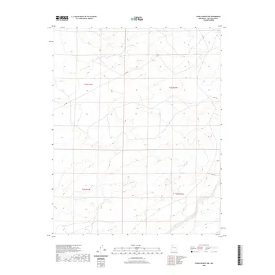
2020 Map of Pueblo Bonito NW
USGS Topo · Published 2020About this map
The high desert landscape of the Eastern Navajo Agency is defined by a network of drainage channels and remote access roads as it appeared in the late 2010s. The primary geological feature is the Ah-shi-sle-pah Wash, which traverses the central and southern portions of the quadrangle. This waterway is joined to the southeast by Kimbeto Wash, while Coal Cr marks the northwest corner. The area is intersected by a grid of rural and industrial routes, including Rd 7650 and Co Rd 7840, which reflect the region's sparse infrastructure and land use patterns. This 2020 edition provides a record of the terrain and public land survey boundaries prior to any more recent development.
Find a feature on this map
12 named features on this map. Tap any name to fly to it.
Don’t see what you’re looking for? This feature index may not catch every label — zoom into the map to look around manually.
Map Details
Editions of this 2020 Pueblo Bonito NW Map
This is the sole edition of this map. No revisions or reprints were ever made.
Other maps of this area

1889 · Largo
USGS Topo · 1:250,000

1889 · Chaco
USGS Topo · 1:250,000

1892 · Chaco
USGS Topo · 1:250,000

1895 · Largo
USGS Topo · 1:250,000

1954 · Shiprock
USGS Topo · 1:250,000

1954 · Aztec
USGS Topo · 1:250,000

1958 · Shiprock
USGS Topo · 1:250,000

1958 · Aztec
USGS Topo · 1:250,000

1959 · Shiprock
USGS Topo · 1:250,000

1962 · Aztec
USGS Topo · 1:250,000