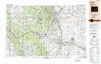
1989 Map of Pueblo
USGS Topo · Published 1989About this map
The Arkansas River carves a path through the heart of the Front Range, passing the dramatic Royal Gorge before reaching the industrial and agricultural hub of Pueblo. During the late 1980s, this region showed a complex landscape of military installations and historic mining districts. The high-altitude gold camps of Cripple Creek and Victor stand in contrast to the expanding urban corridors of Colorado Springs and the sprawling Fort Carson and Peterson Air Force Base.
Find a feature on this map
150 named features on this map. Tap any name to fly to it.
Don’t see what you’re looking for? This feature index may not catch every label — zoom into the map to look around manually.
Map Details
Editions of this 1989 Pueblo Map
This is the sole edition of this map. No revisions or reprints were ever made.
Other maps of this area

1889 · Canon City
USGS Topo · 1:125,000

1889 · Leadville
USGS Topo · 1:125,000

1889 · Huerfano Park
USGS Topo · 1:125,000

1889 · Sanborn
USGS Topo · 1:125,000

1891 · Walsenburg
USGS Topo · 1:125,000

1891 · Sanborn
USGS Topo · 1:125,000

1891 · Catlin
USGS Topo · 1:125,000

1891 · Pueblo
USGS Topo · 1:125,000

1891 · Timpas
USGS Topo · 1:125,000

1891 · Nepesta
USGS Topo · 1:125,000