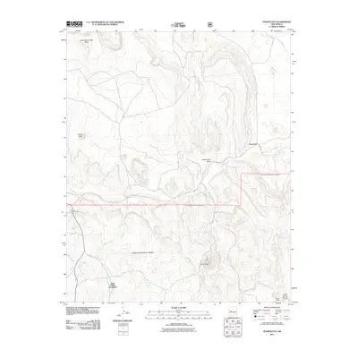
2011 Map of Puertecito
USGS Topo · Published 2011About this map
Puertecito and the John Padilla Settlement anchor this 2011 topographic survey of the Eastern Navajo Agency region. The landscape is defined by the seasonal watercourses of the Rio Salado and Alamo Creek, which carve through the high desert terrain. Public and tribal lands intersect here, with large portions of the Cibola National Forest covering the southern and eastern sectors. Notable elevations like White Peak and La Cruz Peak provide prominent landmarks above the drainages of Cottonwood Draw and Cañada Bonita. Evidence of local community life is visible at the Navajo Community Hall and the Chavez Ranch near Abbe Spring Canyon. The map details a network of rural routes, including Co Rd 28 and the Buricito Rd, which connect these isolated settlements and springs like Alamo Spring across the mesa-and-canyon country.
Find a feature on this map
20 named features on this map. Tap any name to fly to it.
Don’t see what you’re looking for? This feature index may not catch every label — zoom into the map to look around manually.
Map Details
Editions of this 2011 Puertecito Map
This is the sole edition of this map. No revisions or reprints were ever made.
Other maps of this area

1917 · Cerro Verde
USGS Topo · 1:125,000

1917 · Broom Mountain
USGS Topo · 1:125,000

1954 · Socorro
USGS Topo · 1:250,000

1958 · Socorro
USGS Topo · 1:250,000

1962 · Socorro
USGS Topo · 1:250,000

1964 · Indian Mesa
USGS Topo · 1:24,000

1964 · La Jara Peak
USGS Topo · 1:24,000

1964 · Table Mountain
USGS Topo · 1:24,000

1964 · Field Ranch
USGS Topo · 1:24,000

1964 · Puertecito
USGS Topo · 1:24,000
Featured Places
- Eastern Navajo Agency, NM
- John Padilla Settlement, Eastern Navajo Agency
- Puertecito, NM
- Alamo Springs, Eastern Navajo Agency
- Socorro County, NM