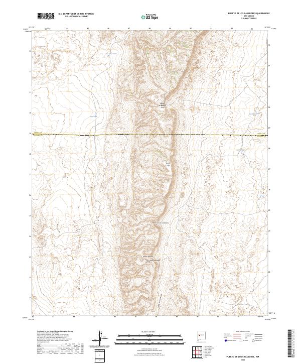
2023 Map of Puerto De Los Cavadores
USGS Topo · Published 2023About this map
Sierra Lucero defines the vertical character of this high-desert landscape on the border of Cibola and Socorro counties. This modern topographic survey highlights a series of distinctive passes or puertitos, including Puerto de Bartolo Pino, Puerto de los Cavadores, and Puerto Vaquita. These natural gaps in the ridge-and-mesa terrain suggest historic paths of movement through the high country, connecting lower basins to the elevated reaches of Mesa de la Cienaga. The scarce water resources of this arid region are carefully documented through several named livestock tanks, such as Crowder Tank, Cordova Tank, and Torres Tank, which provide essential anchor points for ranchers and land managers navigating the expansive public and private lands near Cañon de la Cienaga.
Find a feature on this map
17 named features on this map. Tap any name to fly to it.
Don’t see what you’re looking for? This feature index may not catch every label — zoom into the map to look around manually.
Map Details
Editions of this 2023 Puerto De Los Cavadores Map
This is the sole edition of this map. No revisions or reprints were ever made.
Other maps of this area

1917 · Cerro Verde
USGS Topo · 1:125,000

1954 · Socorro
USGS Topo · 1:250,000

1956 · Mesa Aparejo
USGS Topo · 1:62,500

1958 · Socorro
USGS Topo · 1:250,000

1959 · Riley
USGS Topo · 1:62,500

1962 · Socorro
USGS Topo · 1:250,000

1964 · La Jara Peak
USGS Topo · 1:24,000

1964 · Field Ranch
USGS Topo · 1:24,000
1964 · Cerro Del Oro
USGS Topo · 1:24,000
1964 · Chicken Mountain
USGS Topo · 1:24,000