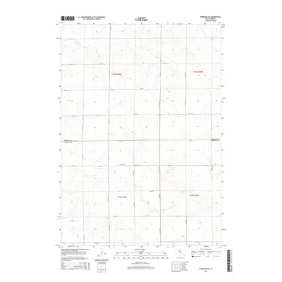
2015 Map of Pukwana NE
USGS Topo · Published 2015About this map
Vega Cem sits near the center of this rural landscape, providing a primary point of reference for genealogists and local historians tracing family roots in the South Dakota prairie. The terrain is defined by the winding paths of Crow Cr in the north and Smith Cr in the south, which cut through the sectional grid of the Public Land Survey System. The map documents the boundary of Buffalo Co Brule Co, showing how the county line bisects the agricultural land between T106N and T105N. A strictly organized network of section-line roads, including 238th ST and 357th Ave, illustrates the late-twentieth and early-twenty-first-century development of the township's transportation infrastructure, designed to serve the dispersed homesteads and farms of the Missouri Plateau region.
Find a feature on this map
22 named features on this map. Tap any name to fly to it.
Don’t see what you’re looking for? This feature index may not catch every label — zoom into the map to look around manually.
Map Details
Editions of this 2015 Pukwana NE Map
This is the sole edition of this map. No revisions or reprints were ever made.
Other maps of this area

1941 · Pukwana
USGS Topo · 1:62,500

1941 · Kimball North
USGS Topo · 1:62,500

1951 · Pukwana
USGS Topo · 1:62,500

1951 · Kimball North
USGS Topo · 1:62,500

1953 · Huron
USGS Topo · 1:250,000

1954 · Huron
USGS Topo · 1:250,000

1955 · Mitchell
USGS Topo · 1:250,000

1959 · Mitchell
USGS Topo · 1:250,000

1973 · Big Bend Dam 4 SE
USGS Topo · 1:24,000

1973 · Gannvalley
USGS Topo · 1:24,000
Featured Places
- Eldorado Township, SD
- Union Township, SD
- Pershing Township, SD
- Crow Creek District, SD
- Lyon Township, SD