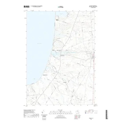
2019 Map of Pulaski
USGS Topo · Published 2019About this map
The Salmon River flows westward through the heart of this Lake Ontario shoreline region, terminating near the village of Port Ontario. The map captures the meeting of land and water along Mexico Bay, where vast protected wetlands like the Deer Creek Wildlife Mgt Area and Selkirk Shores State Park dominate the coast. These areas preserve the environmental character of the eastern lakefront, contrasting with the nearby residential developments at Rainbow Shores and Ramona Beach.
Find a feature on this map
87 named features on this map. Tap any name to fly to it.
Don’t see what you’re looking for? This feature index may not catch every label — zoom into the map to look around manually.
Map Details
Editions of this 2019 Pulaski Map
This is the sole edition of this map. No revisions or reprints were ever made.
Other maps of this area

1895 · Pulaski
USGS Topo · 1:62,500

1900 · Fulton
USGS Topo · 1:62,500

1905 · Mexico
USGS Topo · 1:62,500

1942 · Sandy Creek
USGS Topo · 1:24,000

1943 · Pulaski
USGS Topo · 1:31,680

1943 · New Haven
USGS Topo · 1:31,680

1943 · Richland
USGS Topo · 1:31,680

1943 · Texas
USGS Topo · 1:31,680

1943 · Mexico
USGS Topo · 1:31,680
1943 · Ellisburg
USGS Topo · 1:31,680