2023 Map of Pulaski
USGS Topo · Published 2023About this map
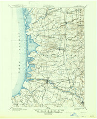
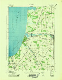
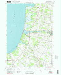
Pulaski serves as the inland anchor of this lakefront landscape, where the Salmon River flows westward toward the expansive waters of Lake Ontario. The village of Port Ontario sits near the river's mouth, flanked by the ecologically significant Deer Creek Wildlife Mgt Area and Selkirk Shores State Park. This modern survey illustrates the proximity between established residential centers and the preserved marshlands of Deer Creek Marsh, showing how the local road network connects these shoreline resources to smaller hamlets like Daysville and Bethel Corners. Genealogists will find several burial grounds noted across the terrain, including Daysville Cem and the uniquely named Parker Ramsey Stevens Cem. The drainage patterns are well-defined by numerous waterways such as Grindstone Creek, Mud Creek, and Snake Creek, which carve through the land south of the river basin.
Find a feature on this map
80 named features on this map. Tap any name to fly to it.
Don’t see what you’re looking for? This feature index may not catch every label — zoom into the map to look around manually.
Map Details
Editions of this 2023 Pulaski Map
This is the sole edition of this map. No revisions or reprints were ever made.
Historical Maps of Rainbow Shores Through Time
5 maps found