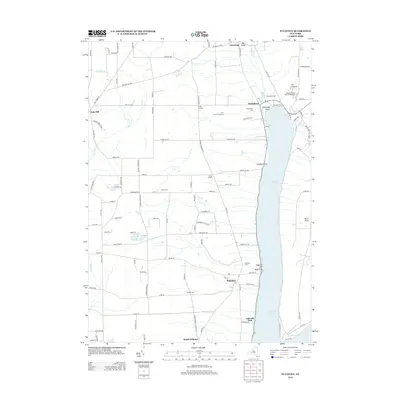
2013 Map of Pulteney
USGS Topo · Published 2013About this map
Keuka Lake dominates the eastern edge of this landscape, its western shores defined by steep terrain and deep ravines like Wagener Glen and Big Gully. The agricultural and viticultural heritage of the region is evident in the presence of Hunt Country Vineyards and various rural settlements including Branchport, Italy Hill, and Pulteney. This 2013 survey provides a clear view of the complex road network connecting these hamlets, such as Guyanoga Rd and Italy Hill Rd, which traverse the heights above the lake. For genealogists, several local burial grounds are identified, including Branchport Cem, Glenview Cem, and Thomas Cem. The map captures a well-established Finger Lakes community where tourism at Lakeside Park and Keuka Lake State Park exists alongside long-standing farming operations and named crossroads like Darby Corners and Gloade Corners.
Find a feature on this map
110 named features on this map. Tap any name to fly to it.
Don’t see what you’re looking for? This feature index may not catch every label — zoom into the map to look around manually.
Map Details
Editions of this 2013 Pulteney Map
This is the sole edition of this map. No revisions or reprints were ever made.
Other maps of this area

1900 · Naples
USGS Topo · 1:62,500

1903 · Naples
USGS Topo · 1:62,500

1903 · Penn Yan
USGS Topo · 1:62,500

1903 · Hammondsport
USGS Topo · 1:62,500

1910 · Bath
USGS Topo · 1:62,500

1913 · Naples
USGS Topo · 1:62,500

1942 · Prattsburg
USGS Topo · 1:31,680

1942 · Penn Yan
USGS Topo · 1:31,680

1942 · Pulteney
USGS Topo · 1:31,680

1942 · Middlesex
USGS Topo · 1:31,680