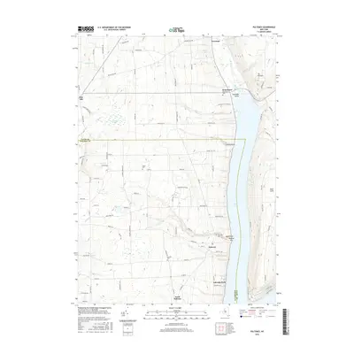
2016 Map of Pulteney
USGS Topo · Published 2016About this map
Keuka Lake dominates the eastern edge of this region, where the steep bluffs of the Finger Lakes meet the upland agricultural plateaus of Yates and Steuben counties. The settlement of Branchport sits at the northern inlet of the west branch of the lake, serving as a gateway to the Guyanoga Valley. Moving south along the western shore, the landscape is defined by deep ravines like Wagener Glen and prominent lookout points such as Boyd Point and Chidsey Point.
Find a feature on this map
88 named features on this map. Tap any name to fly to it.
Don’t see what you’re looking for? This feature index may not catch every label — zoom into the map to look around manually.
Map Details
Editions of this 2016 Pulteney Map
This is the sole edition of this map. No revisions or reprints were ever made.
Other maps of this area

1900 · Naples
USGS Topo · 1:62,500

1903 · Naples
USGS Topo · 1:62,500

1903 · Penn Yan
USGS Topo · 1:62,500

1903 · Hammondsport
USGS Topo · 1:62,500

1910 · Bath
USGS Topo · 1:62,500

1913 · Naples
USGS Topo · 1:62,500

1942 · Prattsburg
USGS Topo · 1:31,680

1942 · Penn Yan
USGS Topo · 1:31,680

1942 · Pulteney
USGS Topo · 1:31,680

1942 · Middlesex
USGS Topo · 1:31,680