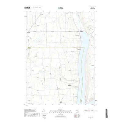
2019 Map of Pulteney
USGS Topo · Published 2019About this map
Keuka Lake dominates the eastern edge of this landscape, its steep shoreline defining the development of small communities like Pulteney and Lakeside Park. The area is characterized by high ridges and deep gullies, with the western uplands around Italy Hill giving way to the dramatic topography of The Pinnacle and Bluff Point overlooking the water. This 2019 survey documents the enduring settlement patterns of the Finger Lakes region, where early roads like Italy Hill Rd and Belknap Hill Rd wind through agricultural lands and forested slopes. Genealogists will find significant local history preserved in burial sites such as Glenview Cem, Branchport Cem, and Pelton Cem, while the confluence of Sugar Creek near Branchport illustrates the traditional water-dependent sites of the early hamlet centers.
Find a feature on this map
93 named features on this map. Tap any name to fly to it.
Don’t see what you’re looking for? This feature index may not catch every label — zoom into the map to look around manually.
Map Details
Editions of this 2019 Pulteney Map
This is the sole edition of this map. No revisions or reprints were ever made.
Other maps of this area

1900 · Naples
USGS Topo · 1:62,500

1903 · Naples
USGS Topo · 1:62,500

1903 · Penn Yan
USGS Topo · 1:62,500

1903 · Hammondsport
USGS Topo · 1:62,500

1910 · Bath
USGS Topo · 1:62,500

1913 · Naples
USGS Topo · 1:62,500

1942 · Prattsburg
USGS Topo · 1:31,680

1942 · Penn Yan
USGS Topo · 1:31,680

1942 · Pulteney
USGS Topo · 1:31,680

1942 · Middlesex
USGS Topo · 1:31,680