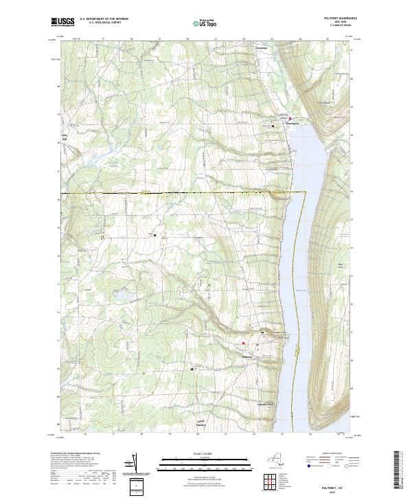
2023 Map of Pulteney
USGS Topo · Published 2023About this map
Keuka Lake dominates this survey, with the western arm of its characteristic Y-shape stretching from Branchport south toward Lakeside Park. The Finger Lakes landscape is defined by steep glacial topography, including The Pinnacle and Wagener Glen, while the western uplands around Italy Hill are carved by drainage systems like Fivemile Creek and Waldo Creek. This modern study reveals the continuing settlement patterns of the Steuben County and Yates County border, where early crossroads like Pulteney remain centers of local life.
Find a feature on this map
95 named features on this map. Tap any name to fly to it.
Don’t see what you’re looking for? This feature index may not catch every label — zoom into the map to look around manually.
Map Details
Editions of this 2023 Pulteney Map
This is the sole edition of this map. No revisions or reprints were ever made.
Other maps of this area

1900 · Naples
USGS Topo · 1:62,500

1903 · Naples
USGS Topo · 1:62,500

1903 · Penn Yan
USGS Topo · 1:62,500

1903 · Hammondsport
USGS Topo · 1:62,500

1910 · Bath
USGS Topo · 1:62,500

1913 · Naples
USGS Topo · 1:62,500

1942 · Prattsburg
USGS Topo · 1:31,680

1942 · Penn Yan
USGS Topo · 1:31,680

1942 · Pulteney
USGS Topo · 1:31,680

1942 · Middlesex
USGS Topo · 1:31,680