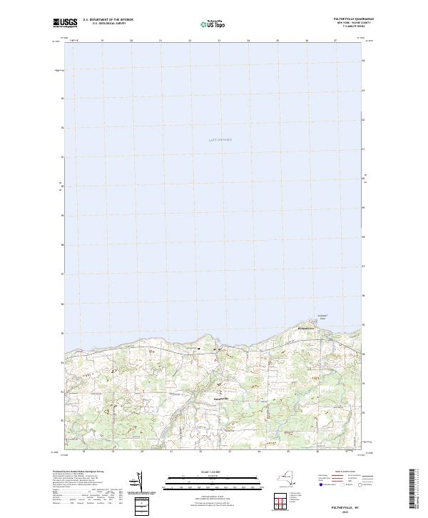
2023 Map of Pultneyville
USGS Topo · Published 2023About this map
Lake Ontario defines the northern edge of this coastal Wayne County landscape, where the hamlet of Pultneyville sits at the mouth of Salmon Creek. The map shows a transition from the structured street grid of the village center to the sprawling orchard and agricultural lands that stretch inland. Distinctive local markers like Fairbanks Point and Holland Cove line the shoreline, while several small tributaries, including Mink Creek, drain northward into the lake.
Find a feature on this map
26 named features on this map. Tap any name to fly to it.
Don’t see what you’re looking for? This feature index may not catch every label — zoom into the map to look around manually.
Map Details
Editions of this 2023 Pultneyville Map
This is the sole edition of this map. No revisions or reprints were ever made.
Other maps of this area

1899 · Palmyra
USGS Topo · 1:62,500

1900 · Macedon
USGS Topo · 1:62,500

1902 · Pultneyville
USGS Topo · 1:62,500

1902 · Palmyra
USGS Topo · 1:62,500

1942 · Ontario
USGS Topo · 1:31,680

1942 · Pultneyville
USGS Topo · 1:31,680

1943 · Williamson
USGS Topo · 1:31,680

1943 · Sodus
USGS Topo · 1:31,680
1952 · Salmon Creek
USGS Topo · 1:24,000
1952 · Pultneyville
USGS Topo · 1:24,000