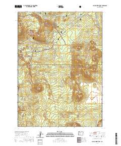
2020 Map of Pumice Desert West
USGS Topo · Published 2020About this map
Crater Lake National Park occupies the southeastern portion of this map, meeting the boundaries of both the Umpqua National Forest and Rogue River National Forest. The high-altitude landscape is defined by volcanic features, most notably the wide expanse of the Pumice Desert and prominent peaks like Bald Crater and Gaywas Peak. These landmarks sit at the headwaters of significant regional waterways, including the Upper Rogue River and Cascade Creek.
Find a feature on this map
38 named features on this map. Tap any name to fly to it.
Don’t see what you’re looking for? This feature index may not catch every label — zoom into the map to look around manually.
Map Details
Editions of this 2020 Pumice Desert West Map
This is the sole edition of this map. No revisions or reprints were ever made.
Other maps of this area

1891 · Ashland
USGS Topo · 1:250,000

1893 · Ashland
USGS Topo · 1:250,000

1897 · Ashland
USGS Topo · 1:250,000

1917 · Diamond Lake
USGS Topo · 1:125,000

1955 · Medford
USGS Topo · 1:250,000

1956 · Diamond Lake
USGS Topo · 1:62,500

1956 · Garwood Butte
USGS Topo · 1:62,500

1956 · Prospect
USGS Topo · 1:62,500

1957 · Medford
USGS Topo · 1:250,000

1958 · Medford
USGS Topo · 1:250,000