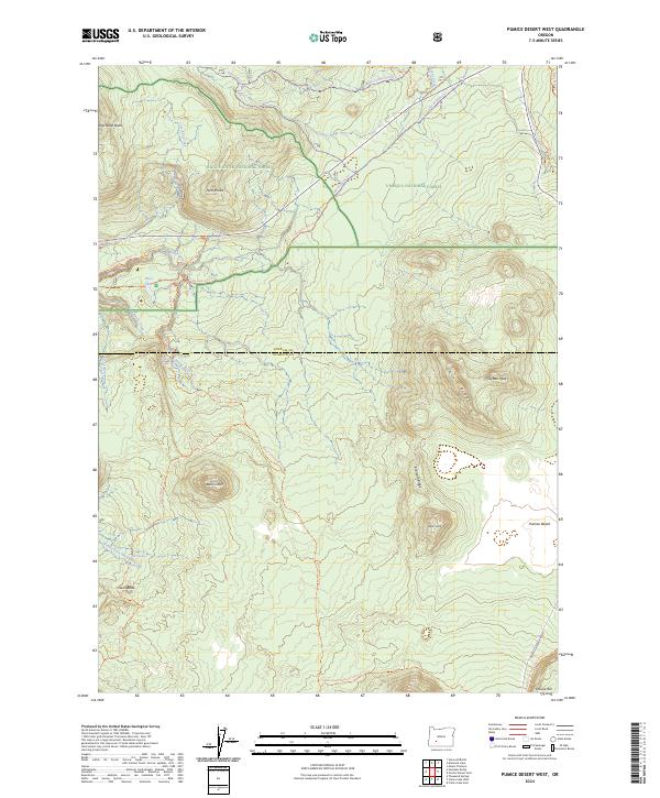
2024 Map of Pumice Desert West
USGS Topo · Published 2024About this map
The Rogue River emerges from the high volcanic terrain along the border of Douglas Co and Klamath Co, carving a path through the Rogue River National Forest. This high-elevation landscape is defined by its namesake Pumice Desert and dramatic cinder cones like Bald Crater and Oasis Butte. The map illustrates a dense network of seasonal trails and forest infrastructure, including the Pacific Crest National Scenic Trl and the Lake West Ohv Trl.
Find a feature on this map
37 named features on this map. Tap any name to fly to it.
Don’t see what you’re looking for? This feature index may not catch every label — zoom into the map to look around manually.
Map Details
Editions of this 2024 Pumice Desert West Map
This is the sole edition of this map. No revisions or reprints were ever made.
Other maps of this area

1891 · Ashland
USGS Topo · 1:250,000

1893 · Ashland
USGS Topo · 1:250,000

1897 · Ashland
USGS Topo · 1:250,000

1917 · Diamond Lake
USGS Topo · 1:125,000

1955 · Medford
USGS Topo · 1:250,000

1956 · Diamond Lake
USGS Topo · 1:62,500

1956 · Garwood Butte
USGS Topo · 1:62,500

1956 · Prospect
USGS Topo · 1:62,500

1957 · Medford
USGS Topo · 1:250,000

1958 · Medford
USGS Topo · 1:250,000