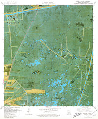
1979 Map of Pumpkin Islands
USGS Topo · Published 1980About this map
Prairie Ridge and Front Ridge define the habitable elevations of this coastal Louisiana landscape, rising above the surrounding marshlands of Vermilion Parish. In the late 1970s, this area was characterized by a complex network of industrial and transport infrastructure designed to navigate the wetlands. The intersection of the Schooner Bayou Canal and the Freshwater Bayou Canal highlights the importance of inland waterways for local commerce and resource extraction. This orthophotomap, produced by the U.S. Geological Survey and the Louisiana Department of Public Works, provides a clear view of the land-use patterns of the era, where small settlements like Prairie Ridge and Front Ridge clung to the higher ground provided by these narrow geological features.
Find a feature on this map
6 named features on this map. Tap any name to fly to it.
Don’t see what you’re looking for? This feature index may not catch every label — zoom into the map to look around manually.
Map Details
Editions of this 1979 Pumpkin Islands Map
This is the sole edition of this map. No revisions or reprints were ever made.
Other maps of this area

1932 · Abbeville SW
USGS Topo · 1:31,680

1932 · Pecan Island SE
USGS Topo · 1:31,680

1932 · Pecan Island SW
USGS Topo · 1:31,680

1945 · Pecan Island NW
USGS Topo · 1:31,680

1945 · Pecan Island NE
USGS Topo · 1:31,680

1946 · Redfish Point SW
USGS Topo · 1:31,680

1946 · Schooner Bayou SE
USGS Topo · 1:31,680

1946 · Redfish Point NW
USGS Topo · 1:31,680

1946 · Schooner Bayou SW
USGS Topo · 1:31,680

1951 · Pecan Island
USGS Topo · 1:62,500