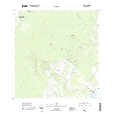
2017 Map of Punaluu
USGS Topo · Published 2017About this map
Hawai'i Volcanoes National Park occupies the northwest corner of this coastal quadrangle, where the massive Lava Flow of 1950 remains a defining geological landmark. The landscape is characterized by a series of dramatic ridges and deep ravines, such as Kaiholena Ridge and Punalu'u Gulch, that descend toward the Pacific. Along the southern shoreline, the Ala Kahakai National Historic Trail connects significant cultural and natural sites, including the black sands of Punalu'u Beach and the freshwater outflows at Ninole Springs. Small settlements like Hilea and Kaiholena are situated inland, while Punalu'u Harbor marks a historic point of coastal access. The map details a complex network of agricultural and natural water features, from the Keaiwa Reservoir in the northeast to the various kahawai and gulches that channel water through the volcanic terrain.
Find a feature on this map
49 named features on this map. Tap any name to fly to it.
Don’t see what you’re looking for? This feature index may not catch every label — zoom into the map to look around manually.
Map Details
Editions of this 2017 Punaluu Map
This is the sole edition of this map. No revisions or reprints were ever made.
Other maps of this area

1921 · Kilauea
USGS Topo · 1:62,500

1923 · Pahala
USGS Topo · 1:62,500

1924 · Kilauea
USGS Topo · 1:62,500

1924 · Honuapo
USGS Topo · 1:62,500

1928 · Mauna Loa
USGS Topo · 1:62,500

1954 · Hawaii South
USGS Topo · 1:250,000

1959 · Hawaii South
USGS Topo · 1:250,000

1961 · Hawaii South
USGS Topo · 1:250,000

1962 · Hawaii South
USGS Topo · 1:250,000

1962 · Kahuku Ranch
USGS Topo · 1:24,000