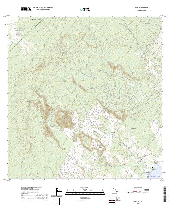
2024 Map of Punaluu
USGS Topo · Published 2024About this map
Hawai'i Volcanoes National Park occupies the northwestern reach of this landscape, characterized by the remnants of the Lava Flow of 1950. The terrain descends from the high ridges of Kaiholena Ridge and Enuhe Ridge toward the coast, where the Pacific Ocean meets Punalu'u Beach. This area preserves a legacy of coastal settlement and agricultural transition, evidenced by Old Plantation Spring and the Keaiwa Reservoir. Near the shore, the Hoku Loa Congregational Church Cem stands as a significant genealogical landmark alongside the ancient sites of Punalu'u Harbor and Ninole Cove. Inland, small clusters like Hilea and Pākanaka are linked by the Hawaii Belt Rd, while numerous gulches such as Punalu'u Gulch carve the volcanic slopes.
Find a feature on this map
52 named features on this map. Tap any name to fly to it.
Don’t see what you’re looking for? This feature index may not catch every label — zoom into the map to look around manually.
Map Details
Editions of this 2024 Punaluu Map
This is the sole edition of this map. No revisions or reprints were ever made.
Other maps of this area

1921 · Kilauea
USGS Topo · 1:62,500

1923 · Pahala
USGS Topo · 1:62,500

1924 · Kilauea
USGS Topo · 1:62,500

1924 · Honuapo
USGS Topo · 1:62,500

1928 · Mauna Loa
USGS Topo · 1:62,500

1954 · Hawaii South
USGS Topo · 1:250,000

1959 · Hawaii South
USGS Topo · 1:250,000

1961 · Hawaii South
USGS Topo · 1:250,000

1962 · Hawaii South
USGS Topo · 1:250,000

1962 · Kahuku Ranch
USGS Topo · 1:24,000