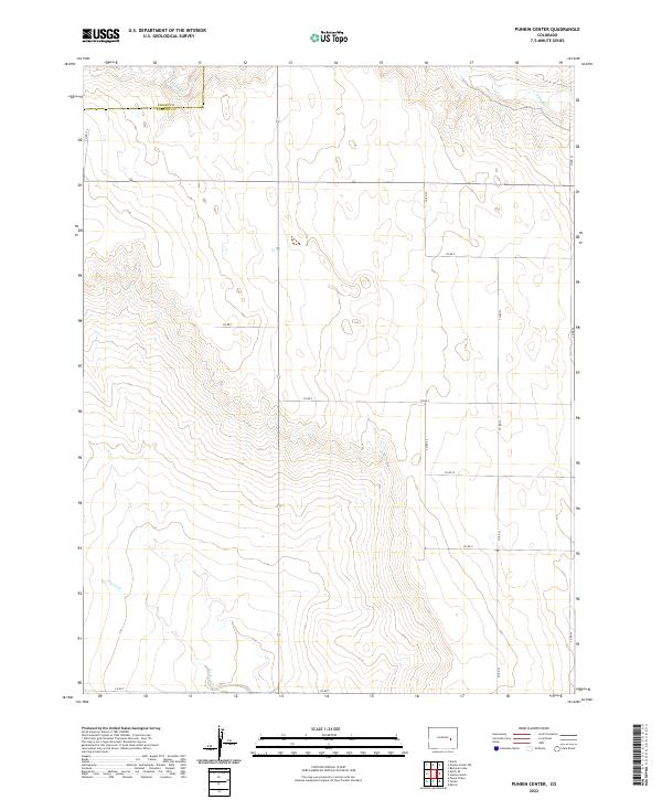
2022 Map of Punkin Center
USGS Topo · Published 2022About this map
The High Plains of eastern Colorado are defined by a grid of rural section roads and ephemeral watercourses in this recent survey. Crossing the border between Elbert Co and Lincoln Co, the landscape is primarily agricultural and undeveloped, characterized by wide drainage basins and subtle elevation shifts. Seasonal waterways like Mustang Cr and S Rush Cr in the northern portion, along with Horse Cr in the south, illustrate the natural drainage patterns that have shaped land use in this part of Lincoln County. The map is dominated by an extensive network of county roads, including Co Rd 17.3 and a series of alphabetical routes from Co Rd Z down to Co Rd T, which provide the primary framework for local travel and farm access. This topographic record highlights the intersection of public land survey system lines and modern infrastructure in a sparsely populated prairie environment.
Find a feature on this map
20 named features on this map. Tap any name to fly to it.
Don’t see what you’re looking for? This feature index may not catch every label — zoom into the map to look around manually.
Map Details
Editions of this 2022 Punkin Center Map
This is the sole edition of this map. No revisions or reprints were ever made.
Other maps of this area

1889 · Sanborn
USGS Topo · 1:125,000

1891 · Sanborn
USGS Topo · 1:125,000

1893 · Sanborn
USGS Topo · 1:125,000

1954 · Lamar
USGS Topo · 1:250,000

1958 · Lamar
USGS Topo · 1:250,000

1975 · Stanley Gulch
USGS Topo · 1:24,000
1975 · Kutch
USGS Topo · 1:24,000

1977 · Punkin Center
USGS Topo · 1:24,000
1978 · Beckman Lake
USGS Topo · 1:24,000
1978 · Peace Valley
USGS Topo · 1:24,000