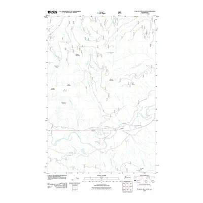
2011 Map of Purcell Mountain
USGS Topo · Published 2011About this map
Cora stands at a crossing of the Cowlitz River, where the Cora Bridge connects local transport routes like Davis Creek Rd and Carr Rd. This landscape in Lewis County is defined by prominent peaks and ridges, including Purcell Mountain and Whalehead Ridge in the west, and Davis Mountain further east. The topography is deeply carved by water systems such as Davis Creek and Karr Creek, which feed into the Cowlitz valley.
Find a feature on this map
40 named features on this map. Tap any name to fly to it.
Don’t see what you’re looking for? This feature index may not catch every label — zoom into the map to look around manually.
Map Details
Editions of this 2011 Purcell Mountain Map
This is the sole edition of this map. No revisions or reprints were ever made.
Other maps of this area

1924 · Mt Rainier
USGS Topo · 1:96,000

1926 · Steamboat Mtn
USGS Topo · 1:125,000

1928 · Mt Rainier
USGS Topo · 1:125,000

1931 · Steamboat Mtn
USGS Topo · 1:125,000

1950 · Yakima
USGS Topo · 1:250,000

1958 · Yakima
USGS Topo · 1:250,000

1961 · Yakima
USGS Topo · 1:250,000

1962 · Randle
USGS Topo · 1:62,500

1962 · Packwood
USGS Topo · 1:62,500
1965 · Greenhorn Buttes
USGS Topo · 1:24,000