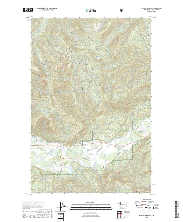
2023 Map of Purcell Mountain
USGS Topo · Published 2023About this map
Purcell Mtn dominates the center of this terrain-heavy survey, which captures a densely forested portion of the Gifford Pinchot National Forest. To the south, the landscape transitions into the alluvial plains of Big Bottom, where the Cowlitz River and its associated Purcell Slough cut through the lowlands. This area is characterized by a network of drainage systems including Cunningham Creek and Mullins Creek, alongside rural routes like Pompey Peak Dr and Cline Rd. In the higher elevations, isolated landmarks like Little Paradise and the high point at Pompey Peak are accessible via the Purcell Mountain Trl and Pompey Peak Trl. The map illustrates the contrast between the steep, ridge-defining topography of Whalehead Ridge and the active river-fed valleys that sustained early settlement in this part of Lewis County.
Find a feature on this map
50 named features on this map. Tap any name to fly to it.
Don’t see what you’re looking for? This feature index may not catch every label — zoom into the map to look around manually.
Map Details
Editions of this 2023 Purcell Mountain Map
This is the sole edition of this map. No revisions or reprints were ever made.
Other maps of this area

1924 · Mt Rainier
USGS Topo · 1:96,000

1926 · Steamboat Mtn
USGS Topo · 1:125,000

1928 · Mt Rainier
USGS Topo · 1:125,000

1931 · Steamboat Mtn
USGS Topo · 1:125,000

1950 · Yakima
USGS Topo · 1:250,000

1958 · Yakima
USGS Topo · 1:250,000

1961 · Yakima
USGS Topo · 1:250,000

1962 · Randle
USGS Topo · 1:62,500

1962 · Packwood
USGS Topo · 1:62,500
1965 · Greenhorn Buttes
USGS Topo · 1:24,000