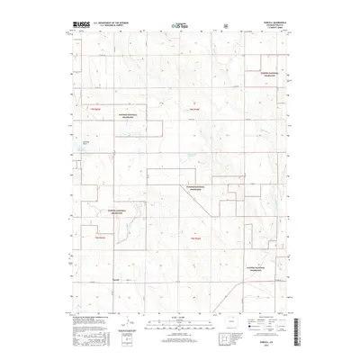
2016 Map of Purcell
USGS Topo · Published 2016About this map
Purcell serves as a focal point in this section of Weld County, positioned along Carlin St near the intersection of several county roads. The landscape is defined by the expansive Pawnee National Grassland, which dominates much of the terrain with its characteristic open plains. Hydrological features such as the Thomas Lake Reservoir and McGrew Reservoir provide essential water management in an area marked by seasonal drainage patterns from Coal Cr and Wildhorse Cr. The topographical variety is further illustrated by the Eastman Basin, showcasing the subtle but significant depressions that characterize the high plains. This 2016 survey illustrates the modern configuration of rural infrastructure, including a grid of numbered county roads like Co RD 90 and Co RD 49 that segment the grassland and support the local agricultural community.
Find a feature on this map
21 named features on this map. Tap any name to fly to it.
Don’t see what you’re looking for? This feature index may not catch every label — zoom into the map to look around manually.
Map Details
Editions of this 2016 Purcell Map
This is the sole edition of this map. No revisions or reprints were ever made.
Other maps of this area

1908 · Eaton
USGS Topo · 1:125,000

1910 · Eaton
USGS Topo · 1:125,000

1954 · Greeley
USGS Topo · 1:250,000

1957 · Greeley
USGS Topo · 1:250,000

1958 · Greeley
USGS Topo · 1:250,000

1960 · Purcell
USGS Topo · 1:24,000
1960 · Eaton
USGS Topo · 1:24,000
1960 · Galeton
USGS Topo · 1:24,000
1960 · Antelope Reservoir
USGS Topo · 1:24,000

1961 · Greeley
USGS Topo · 1:250,000