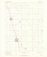
1960 Map of Eaton
USGS Topo · Published 1962About this map
Agricultural development in the high plains north of Greeley is clearly defined on this 1960 survey, dominated by a sophisticated irrigation network that sustained the towns of Ault and Eaton. The Union Pacific railroad corridor serves as the primary axis for these settlements, which are surrounded by essential water management features like the Eaton Ditch, Eaton Aqueduct, and numerous reservoirs including Clark Lake and Cozzens Lake. The map provides a detailed view of local infrastructure at mid-century, from the Eaton Cem and Ault Cem to the outlying Wyatt Sch.
Find a feature on this map
24 named features on this map. Tap any name to fly to it.
Don’t see what you’re looking for? This feature index may not catch every label — zoom into the map to look around manually.
Map Details
Editions of this 1960 Eaton Map
4 editions found
Other maps of this area

1902 · Greeley
USGS Topo · 1:125,000

1908 · Eaton
USGS Topo · 1:125,000

1910 · Eaton
USGS Topo · 1:125,000

1950 · Greeley
USGS Topo · 1:24,000

1950 · Kersey
USGS Topo · 1:24,000

1950 · Bracewell
USGS Topo · 1:24,000
1951 · Bracewell
USGS Topo · 1:24,000

1954 · Greeley
USGS Topo · 1:250,000

1957 · Greeley
USGS Topo · 1:250,000

1958 · Greeley
USGS Topo · 1:250,000