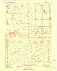
1951 Map of Bracewell
USGS Topo · Published 1951About this map
The irrigation-led landscape of Weld County unfolds across this 1951 study, centered on the small siding of Bracewell and the complex network of canals feeding the South Platte basin. The Cache La Poudre River winds through the mid-section, flanked by an intricate web of water management features including the Greeley No 2 Canal, Whitney Ditch, and Gravine Ditch. These waterways supported the surrounding agricultural communities and livestock operations, as evidenced by landmarks like the Neill Bros Reservoir and Hogarty Reservoir.
Find a feature on this map
35 named features on this map. Tap any name to fly to it.
Don’t see what you’re looking for? This feature index may not catch every label — zoom into the map to look around manually.
Map Details
Editions of this 1951 Bracewell Map
2 editions found
Other maps of this area

1902 · Greeley
USGS Topo · 1:125,000

1908 · Eaton
USGS Topo · 1:125,000

1910 · Eaton
USGS Topo · 1:125,000

1950 · Greeley
USGS Topo · 1:24,000

1950 · Windsor
USGS Topo · 1:24,000

1950 · Johnstown
USGS Topo · 1:24,000

1950 · Bracewell
USGS Topo · 1:24,000

1950 · Milliken
USGS Topo · 1:24,000

1950 · La Salle
USGS Topo · 1:24,000
1951 · Johnstown
USGS Topo · 1:24,000