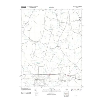
2010 Map of Purcellville
USGS Topo · Published 2010About this map
Purcellville and the neighboring town of Hamilton anchor this study of the Loudoun Valley, where the agricultural legacy of Northern Virginia meets early 21st-century growth. The landscape is defined by the drainages of the North Fork Catoctin Creek and South Fork Catoctin Creek, which flow through a countryside dotted with historic crossroads like Morrisonville, Wheatland, and Everharts Crossroads. Under the shadow of Short Hill Mountain, the region's deep community roots are evidenced by numerous burial grounds, including the Salem Cemetery, Rehoboth Cemetery, and Ketocktin Cemetery. Local landmarks such as the Crooked Run Orchard and the Purcellville Post Office highlight the mix of rural industry and civic life. The presence of the Wash and Old Dominion Bike Trl following the former railroad corridor illustrates the transition of the region's transport infrastructure from heavy rail to recreational use.
Find a feature on this map
69 named features on this map. Tap any name to fly to it.
Don’t see what you’re looking for? This feature index may not catch every label — zoom into the map to look around manually.
Map Details
Editions of this 2010 Purcellville Map
This is the sole edition of this map. No revisions or reprints were ever made.
Other maps of this area

1884 · Harpers Ferry
USGS Topo · 1:125,000

1891 · Harpers Ferry
USGS Topo · 1:125,000

1893 · Harpers Ferry
USGS Topo · 1:125,000

1908 · Middletown
USGS Topo · 1:48,000

1910 · Antietam
USGS Topo · 1:62,500

1914 · Martinsburg
USGS Topo · 1:48,000

1916 · Martinsburg
USGS Topo · 1:62,500

1916 · Berryville
USGS Topo · 1:62,500

1939 · Berryville
USGS Topo · 1:48,000

1943 · Bluemont
USGS Topo · 1:24,000