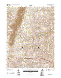
2013 Map of Purcellville
USGS Topo · Published 2013About this map
Purcellville and Hamilton anchor the southern portion of this northern Virginia landscape, where the foothills of Short Hill Mountain meet the drainage basins of the Catoctin Creek forks. The map reveals a transition from the established residential grids of the larger towns to a pattern of outlying settlements and historic crossroads. Historically significant points like Morrisonville, Hillsboro, and Everharts Crossroads are connected by a network of rural routes including Hillsboro Rd and Bolington Rd. Agriculture remains a defining characteristic of the area, evidenced by the presence of Crooked Run Orchard and the Rosemont Farm. The terrain is shaped by numerous waterways such as N Fork Catoctin Cr, S Fork Catoctin Cr, and Mill Creek, which historically supported milling operations in locations like Milltown. Notable local landmarks like Krens Farm Airport and Arlington Corner provide further geographical context for this portion of Loudoun County.
Find a feature on this map
62 named features on this map. Tap any name to fly to it.
Don’t see what you’re looking for? This feature index may not catch every label — zoom into the map to look around manually.
Map Details
Editions of this 2013 Purcellville Map
This is the sole edition of this map. No revisions or reprints were ever made.
Other maps of this area

1884 · Harpers Ferry
USGS Topo · 1:125,000

1891 · Harpers Ferry
USGS Topo · 1:125,000

1893 · Harpers Ferry
USGS Topo · 1:125,000

1908 · Middletown
USGS Topo · 1:48,000

1910 · Antietam
USGS Topo · 1:62,500

1914 · Martinsburg
USGS Topo · 1:48,000

1916 · Martinsburg
USGS Topo · 1:62,500

1916 · Berryville
USGS Topo · 1:62,500

1939 · Berryville
USGS Topo · 1:48,000

1943 · Bluemont
USGS Topo · 1:24,000