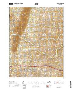
2019 Map of Purcellville
USGS Topo · Published 2019About this map
Purcellville and Hamilton anchor the southern reach of this landscape in the late 2010s, where the suburban edges of the Washington metropolitan area meet the agricultural heritage of the Loudoun Valley. The terrain is dominated by the prominent ridge of Short Hill Mtn in the northwest, which overlooks several small rural clusters such as Hillsboro, Mechanicsville, and Morrisonville. This area is particularly rich in genealogical sites, featuring numerous burial grounds including Salem Cem, Arnold Grove Cem, and Ketockin Cem.
Find a feature on this map
184 named features on this map. Tap any name to fly to it.
Don’t see what you’re looking for? This feature index may not catch every label — zoom into the map to look around manually.
Map Details
Editions of this 2019 Purcellville Map
This is the sole edition of this map. No revisions or reprints were ever made.
Other maps of this area

1884 · Harpers Ferry
USGS Topo · 1:125,000

1891 · Harpers Ferry
USGS Topo · 1:125,000

1893 · Harpers Ferry
USGS Topo · 1:125,000

1908 · Middletown
USGS Topo · 1:48,000

1910 · Antietam
USGS Topo · 1:62,500

1914 · Martinsburg
USGS Topo · 1:48,000

1916 · Martinsburg
USGS Topo · 1:62,500

1916 · Berryville
USGS Topo · 1:62,500

1939 · Berryville
USGS Topo · 1:48,000

1943 · Bluemont
USGS Topo · 1:24,000