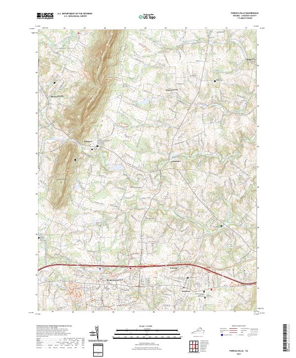
2022 Map of Purcellville
USGS Topo · Published 2022About this map
Loudoun Valley agriculture and residential expansion define this portrait of northern Virginia, where the historic town of Purcellville serves as a regional hub. The landscape is characterized by the rolling terrain of the Short Hill Mtn and the winding courses of the N Fork Catoctin Cr and S Fork Catoctin Cr. Genealogists will find a wealth of data across several rural burial grounds, including the Ketoctin Baptist Church Cem and the Arnold Grove Methodist Episcopal Church Cem. In the southern portion of the sheet, Patrick Henry College stands near the outskirts of town, while smaller crossroads such as Wheatland and Morrisonville maintain their identity amidst the horse farms and vineyards of the Piedmont. These settlements, connected by historic routes like the Charles Town Pike, reflect centuries of continuous habitation and the transition from traditional farming to modern suburban connectivity.
Find a feature on this map
199 named features on this map. Tap any name to fly to it.
Don’t see what you’re looking for? This feature index may not catch every label — zoom into the map to look around manually.
Map Details
Editions of this 2022 Purcellville Map
This is the sole edition of this map. No revisions or reprints were ever made.
Other maps of this area

1884 · Harpers Ferry
USGS Topo · 1:125,000

1891 · Harpers Ferry
USGS Topo · 1:125,000

1893 · Harpers Ferry
USGS Topo · 1:125,000

1908 · Middletown
USGS Topo · 1:48,000

1910 · Antietam
USGS Topo · 1:62,500

1914 · Martinsburg
USGS Topo · 1:48,000

1916 · Martinsburg
USGS Topo · 1:62,500

1916 · Berryville
USGS Topo · 1:62,500

1939 · Berryville
USGS Topo · 1:48,000

1943 · Bluemont
USGS Topo · 1:24,000