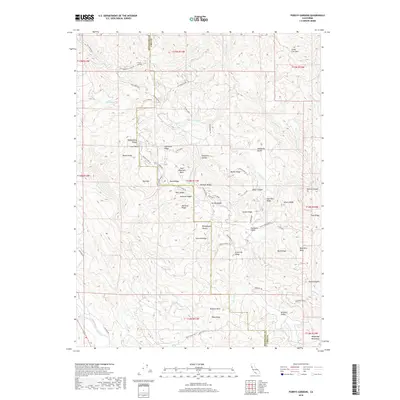
2018 Map of Purdys Gardens
USGS Topo · Published 2018About this map
Purdys Gardens sits at the northern edge of this high-elevation landscape straddling the Mendocino and Lake County line. This 2018 survey reveals a terrain defined by complex ridge systems and secluded basins, most notably the central Red Mountain Basin and the adjacent Basin Ridge. The region is marked by numerous high glades and valleys, such as Rickabaugh Glades, Eightmile Valley, and Fourmile Glade, which suggest a history of seasonal grazing or upland resource use. To the south, the Pratt Ranch stands near the headwaters of Parsons Creek, while the northwestern corner is dominated by the steep slopes of Cow Mountain. Small upland water bodies like Hagan Lake, Coon Lake, and Rocky Lake are tucked between the folds of Morrison Ridge and Pyramid Ridge, providing essential water sources in this dry, elevated country.
Find a feature on this map
117 named features on this map. Tap any name to fly to it.
Don’t see what you’re looking for? This feature index may not catch every label — zoom into the map to look around manually.
Map Details
Editions of this 2018 Purdys Gardens Map
This is the sole edition of this map. No revisions or reprints were ever made.
Other maps of this area

1920 · Ukiah
USGS Topo · 1:62,500

1921 · Kelseyville
USGS Topo · 1:62,500

1938 · Lakeport
USGS Topo · 1:62,500

1938 · Hopland
USGS Topo · 1:62,500

1943 · Kelseyville
USGS Topo · 1:62,500

1943 · Hopland
USGS Topo · 1:62,500

1944 · Ukiah
USGS Topo · 1:62,500

1944 · Hopland
USGS Topo · 1:62,500

1947 · Santa Rosa
USGS Topo · 1:250,000

1949 · Santa Rosa
USGS Topo · 1:250,000