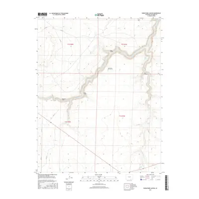
2016 Map of Purgatoire Canyon
USGS Topo · Published 2016About this map
The Purgatoire River carves a deep, winding path through this corner of Las Animas County, creating a landscape defined by dramatic elevation changes and steep side-drainages. This 2016 survey captures a sparsely populated region where life and travel are dictated by the canyon's geography. Evidence of local heritage and spiritual life is preserved at the Los Hermanos Penitentes Cem and Mestas Cem, both situated on higher ground overlooking the river's path. Water sources are critical in this arid environment, marked by named points such as Rail O Spring, Eastside Spring, and the uniquely titled Million Dollar Water Hole. The map details a network of canyons including Miller Canyon and Perea Canyon, while the southern reaches show the descent of Trinchera Cr toward the Trinchera Falls.
Find a feature on this map
25 named features on this map. Tap any name to fly to it.
Don’t see what you’re looking for? This feature index may not catch every label — zoom into the map to look around manually.
Map Details
Editions of this 2016 Purgatoire Canyon Map
This is the sole edition of this map. No revisions or reprints were ever made.
Other maps of this area

1891 · Mesa De Maya
USGS Topo · 1:125,000

1892 · Elmoro
USGS Topo · 1:125,000

1893 · Elmoro
USGS Topo · 1:125,000

1893 · Mesa de Maya
USGS Topo · 1:125,000

1897 · Elmoro
USGS Topo · 1:125,000

1954 · Trinidad
USGS Topo · 1:250,000

1955 · La Junta
USGS Topo · 1:250,000

1955 · Trinidad
USGS Topo · 1:250,000

1958 · La Junta
USGS Topo · 1:250,000

1958 · Trinidad
USGS Topo · 1:250,000