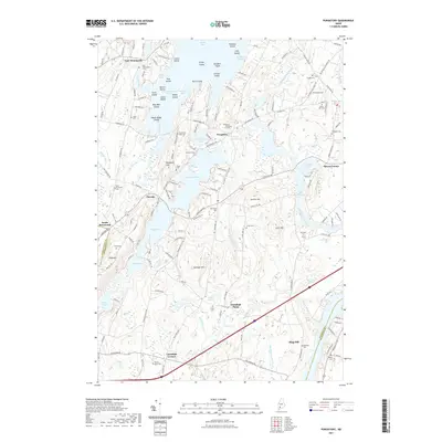
2021 Map of Purgatory
USGS Topo · Published 2021About this map
Cobbosseecontee Lake and its many islands, including Merrill Island and Pine Island, dominate the northern landscape of this Kennebec County region. The settlement of Purgatory sits at the head of Little Purgatory Pond, where the Purgatory Burial Ground and Gilman Dam Pond reflect the area's early 19th-century mill history and rural community structure. The terrain is defined by distinct elevations like Woodbury Hills and Dennis Hill, interspersed with a complex network of water bodies such as Sand Pond and Buker Pond. Genealogists will find a significant concentration of family and community burial sites, from the Smith-Baker Cem near Litchfield Corners to the Lyons Cem and Pease Cem. The southern reach shows the transition into Sagadahoc County, marked by the agricultural layout of Litchfield Plains and the drainage of Ashford Brook toward Mill Pond.
Find a feature on this map
168 named features on this map. Tap any name to fly to it.
Don’t see what you’re looking for? This feature index may not catch every label — zoom into the map to look around manually.
Map Details
Editions of this 2021 Purgatory Map
This is the sole edition of this map. No revisions or reprints were ever made.
Other maps of this area

1892 · Gardiner
USGS Topo · 1:62,500

1892 · Augusta
USGS Topo · 1:62,500

1908 · Lewiston
USGS Topo · 1:62,500

1910 · Livermore
USGS Topo · 1:62,500

1912 · Livermore
USGS Topo · 1:62,500

1941 · Livermore
USGS Topo · 1:62,500

1941 · Augusta
USGS Topo · 1:62,500

1942 · Lewiston
USGS Topo · 1:62,500

1943 · Augusta
USGS Topo · 1:62,500

1943 · Gardiner
USGS Topo · 1:62,500