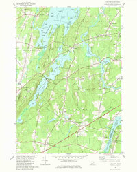
1980 Map of Purgatory
USGS Topo · Published 1980About this map
The complex shoreline of Cobbosseecontee Lake and the interconnected Tacoma Lakes dominate this 1980 survey of south-central Maine. The landscape is a mosaic of water and high ground, featuring dozens of named points and islands such as Goodwin Island and Norris Pt. Settlement patterns here are defined by historic road junctions and crossings, from South Monmouth in the west to the cluster of schools and cemeteries near Litchfield Corners in the south.
Find a feature on this map
92 named features on this map. Tap any name to fly to it.
Don’t see what you’re looking for? This feature index may not catch every label — zoom into the map to look around manually.
Map Details
Editions of this 1980 Purgatory Map
This is the sole edition of this map. No revisions or reprints were ever made.
Other maps of this area

1892 · Gardiner
USGS Topo · 1:62,500

1892 · Augusta
USGS Topo · 1:62,500

1908 · Lewiston
USGS Topo · 1:62,500

1910 · Livermore
USGS Topo · 1:62,500

1912 · Livermore
USGS Topo · 1:62,500

1941 · Livermore
USGS Topo · 1:62,500

1941 · Augusta
USGS Topo · 1:62,500

1942 · Lewiston
USGS Topo · 1:62,500

1943 · Augusta
USGS Topo · 1:62,500

1943 · Gardiner
USGS Topo · 1:62,500