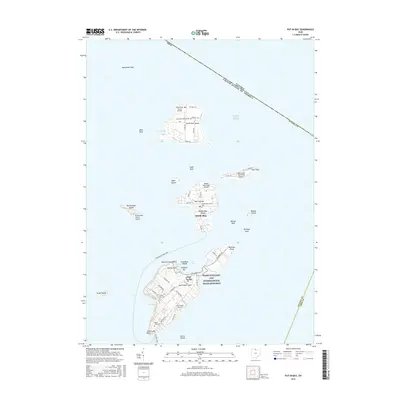
2016 Map of Put-in-Bay
USGS Topo · Published 2016About this map
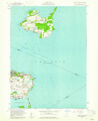
Lake Erie surrounds the Bass Islands in this 2016 survey, a region defined by maritime heritage and the international border between the United States and Canada. South Bass Island serves as the focal point of local activity, anchored by the village of Put-in-Bay and the towering Perry's Victory and International Peace Memorial. The landscape transitions from the dense street grids of the village, including Columbus Ave and Catawba Ave, to the more secluded stretches of Middle Bass Island and the northernmost North Bass Island. Small airports on nearly every major landmass, such as the Rattlesnake Island Airport and Middle Bass Island Airport, highlight the unique logistical challenges and island-hopping nature of this archipelago. Genealogical interest is centered on several local grounds, including Maple Leaf Cem and Crown Hill Cem, while the rugged shoreline is marked by hazards like Northwest Reef and Buckeye Reef.
Find a feature on this map
65 named features on this map. Tap any name to fly to it.
Don’t see what you’re looking for? This feature index may not catch every label — zoom into the map to look around manually.
Map Details
Editions of this 2016 Put-in-Bay Map
This is the sole edition of this map. No revisions or reprints were ever made.
Other maps of this area

1901 · Put-In-Bay
USGS Topo · 1:62,500

1903 · Put In Bay
USGS Topo · 1:62,500

1916 · Kelleys Island
USGS Topo · 1:62,500

1919 · Kelleys Island
USGS Topo · 1:62,500

1956 · Toledo
USGS Topo · 1:250,000
1959 · Port Clinton
USGS Topo · 1:24,000
1959 · Gypsum
USGS Topo · 1:24,000
1959 · Put-In-Bay
USGS Topo · 1:24,000
1959 · Kelleys Island
USGS Topo · 1:24,000

1961 · Toledo
USGS Topo · 1:250,000