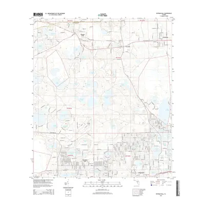
2015 Map of Putnam Hall
USGS Topo · Published 2015About this map
The lake-strewn landscape of western Putnam County is defined here by the dense cluster of settlements at Interlachen and the smaller outposts of Putnam Hall and Grandin. This karst topography is punctuated by dozens of named water bodies, ranging from the large Lake Chipco to the smaller Hour Glass Lake, Trotting Pond, and Still Pond. The map reveals a community structured by historic road networks and cemeteries, including Abline Cem, Sister Spring Cem, and Pineview Cem. The Florida National Scenic Trail winds through the northern sections, passing near Paran Church and reflecting the modern recreational use of this interior Florida terrain. The layout of Florahome in the northeast and Oak Ridge Park further south shows the varied residential patterns of the area, while the many lakes, such as Lake Serena and Lake Loyal, highlight the fundamental role of hydrography in local geography.
Find a feature on this map
310 named features on this map. Tap any name to fly to it.
Don’t see what you’re looking for? This feature index may not catch every label — zoom into the map to look around manually.
Map Details
Editions of this 2015 Putnam Hall Map
This is the sole edition of this map. No revisions or reprints were ever made.
Other maps of this area

1915 · Interlachen
USGS Topo · 1:48,000

1916 · Interlachen
USGS Topo · 1:62,500

1938 · Hawthorn
USGS Topo · 1:48,000

1941 · Starke
USGS Topo · 1:62,500

1942 · Ates Creek
USGS Topo · 1:62,500

1943 · Hawthorn
USGS Topo · 1:62,500

1944 · Interlachen
USGS Topo · 1:62,500

1948 · Starke
USGS Topo · 1:50,000

1949 · Rice Creek
USGS Topo · 1:24,000

1949 · Keuka
USGS Topo · 1:24,000