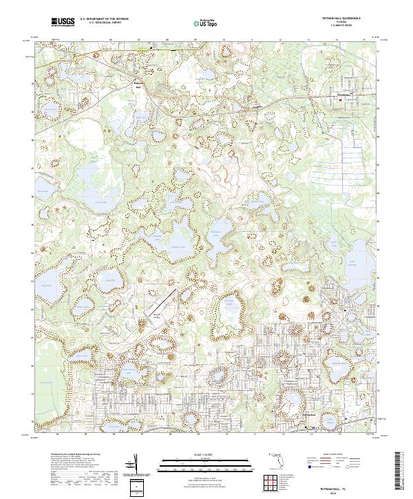
2024 Map of Putnam Hall
USGS Topo · Published 2024About this map
Putnam Hall and Grandin anchor this north Florida landscape, which is defined by a dense network of lakes, prairies, and depressions. The topography transitions from the wet expanses of Putnam Prairie and Levys Prairie to the industrial operations at the Grandin Sand Plant. This modern survey details the evolving residential patterns around Melrose Landing and the northern reaches of Interlachen, where numerous small water bodies like Cue Lake and Whirlwind Lake dictate the layout of local roads and subdivisions.
Find a feature on this map
112 named features on this map. Tap any name to fly to it.
Don’t see what you’re looking for? This feature index may not catch every label — zoom into the map to look around manually.
Map Details
Editions of this 2024 Putnam Hall Map
This is the sole edition of this map. No revisions or reprints were ever made.
Other maps of this area

1915 · Interlachen
USGS Topo · 1:48,000

1916 · Interlachen
USGS Topo · 1:62,500

1938 · Hawthorn
USGS Topo · 1:48,000

1941 · Starke
USGS Topo · 1:62,500

1942 · Ates Creek
USGS Topo · 1:62,500

1943 · Hawthorn
USGS Topo · 1:62,500

1944 · Interlachen
USGS Topo · 1:62,500

1948 · Starke
USGS Topo · 1:50,000

1949 · Rice Creek
USGS Topo · 1:24,000

1949 · Keuka
USGS Topo · 1:24,000