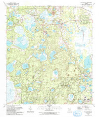
1993 Map of Putnam Hall
USGS Topo · Published 1993About this map
Putnam Hall and Grandin sit within a landscape defined by an intricate network of sinkhole lakes and wetlands along the Clay Co Putnam Co border. This region, characterized by its dense cluster of water bodies like Lake Serena, Wall Lake, and the sprawling Lake Grandin, reflects a rural Florida economy transitioning toward recreation and aviation by the early 1990s. The presence of the Melrose Landing Airstrip and numerous boat ramps alongside established communities suggests a shift from the area's agricultural roots, though older footprints remain visible through the Paran Ch & Cem and Abilene Ch.
Find a feature on this map
64 named features on this map. Tap any name to fly to it.
Don’t see what you’re looking for? This feature index may not catch every label — zoom into the map to look around manually.
Map Details
Editions of this 1993 Putnam Hall Map
This is the sole edition of this map. No revisions or reprints were ever made.
Other maps of this area

1915 · Interlachen
USGS Topo · 1:48,000

1916 · Interlachen
USGS Topo · 1:62,500

1938 · Hawthorn
USGS Topo · 1:48,000

1941 · Starke
USGS Topo · 1:62,500

1942 · Ates Creek
USGS Topo · 1:62,500

1943 · Hawthorn
USGS Topo · 1:62,500

1944 · Interlachen
USGS Topo · 1:62,500

1948 · Starke
USGS Topo · 1:50,000

1949 · Rice Creek
USGS Topo · 1:24,000

1949 · Keuka
USGS Topo · 1:24,000