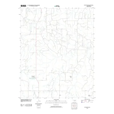
2010 Map of Putnam NW
USGS Topo · Published 2010About this map
Fairview Cemetery serves as a quiet landmark in this section of Dewey County, where the landscape is defined by the drainages of Trail Creek and Sorter Creek. This 2010 survey illustrates a region heavily managed for water conservation and soil stability through several engineering projects. Prominent among these is the Boggess Erosion Control Number 1 Reservoir, supported by the Boggess Erosion Control Number 1 Dam. Other infrastructure such as the Boggess Number 2 Dam and Roaring Creek Site 17 Dam further indicate the hydrological priorities of the area. A grid of section roads, including n2250 RD and e0710 RD, connects the rural homesteads and agricultural plots, while U.S. Highway 183 provides the primary north-south transit corridor through the western portion of the quadrangle.
Find a feature on this map
23 named features on this map. Tap any name to fly to it.
Don’t see what you’re looking for? This feature index may not catch every label — zoom into the map to look around manually.
Map Details
Editions of this 2010 Putnam NW Map
This is the sole edition of this map. No revisions or reprints were ever made.
Other maps of this area

1955 · Clinton
USGS Topo · 1:250,000

1955 · Woodward
USGS Topo · 1:250,000

1957 · Clinton
USGS Topo · 1:250,000

1958 · Woodward
USGS Topo · 1:250,000

1962 · Putnam
USGS Topo · 1:62,500

1962 · Aledo
USGS Topo · 1:62,500

1969 · Lenora
USGS Topo · 1:24,000

1972 · Hucmac
USGS Topo · 1:24,000
1972 · Taloga
USGS Topo · 1:24,000

1984 · Foss Reservoir
USGS Topo · 1:100,000