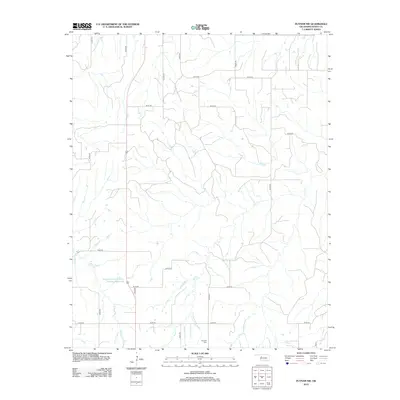
2012 Map of Putnam NW
USGS Topo · Published 2012About this map
Fairview Cem serves as a primary genealogical landmark in this section of Dewey County, where the landscape is defined by the headwaters and tributaries of Trail Cr and Sorter Cr. This 2012 survey illustrates the modern rural infrastructure of Western Oklahoma, characterized by a highly regular grid of section-line roads such as n2270 RD and e0720 RD that partition the agricultural land. An interesting intersection of land management and hydrology is visible at the Boggess Erosion Control Number 1 Reservoir, which regulates local drainage. The map provides a clear view of the dispersed settlement patterns typical of the region, where family farms are linked by a network of numbered county roads that follow the surveyed sections across the Oklahoma prairie.
Find a feature on this map
20 named features on this map. Tap any name to fly to it.
Don’t see what you’re looking for? This feature index may not catch every label — zoom into the map to look around manually.
Map Details
Editions of this 2012 Putnam NW Map
This is the sole edition of this map. No revisions or reprints were ever made.
Other maps of this area

1955 · Clinton
USGS Topo · 1:250,000

1955 · Woodward
USGS Topo · 1:250,000

1957 · Clinton
USGS Topo · 1:250,000

1958 · Woodward
USGS Topo · 1:250,000

1962 · Putnam
USGS Topo · 1:62,500

1962 · Aledo
USGS Topo · 1:62,500

1969 · Lenora
USGS Topo · 1:24,000

1972 · Hucmac
USGS Topo · 1:24,000
1972 · Taloga
USGS Topo · 1:24,000

1984 · Foss Reservoir
USGS Topo · 1:100,000