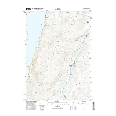
2016 Map of Putnam
USGS Topo · Published 2016About this map
Lake George and Lake Champlain define the eastern and western edges of this landscape, separated by the high ridgelines of the Adirondack Park. The terrain is characterized by steep peaks such as Spruce Mtn and Hogback Mtn, while human activity is concentrated along the narrow shorelines and valley corridors. Small settlements like Dresden and Putnam are connected by a network of winding roads, including the Military Rd and Dresden Hill Rd, which navigate the elevation changes between the lakes.
Find a feature on this map
89 named features on this map. Tap any name to fly to it.
Don’t see what you’re looking for? This feature index may not catch every label — zoom into the map to look around manually.
Map Details
Editions of this 2016 Putnam Map
This is the sole edition of this map. No revisions or reprints were ever made.
Other maps of this area

1893 · Whitehall
USGS Topo · 1:62,500

1894 · Ticonderoga
USGS Topo · 1:62,500

1895 · Whitehall
USGS Topo · 1:62,500

1895 · Paradox Lake
USGS Topo · 1:62,500

1896 · Ticonderoga
USGS Topo · 1:62,500

1897 · Bolton
USGS Topo · 1:62,500

1897 · Paradox Lake
USGS Topo · 1:62,500

1898 · Whitehall
USGS Topo · 1:62,500

1900 · Bolton
USGS Topo · 1:62,500

1902 · Whitehall
USGS Topo · 1:62,500